Open-source toolbox
The World Ecosystem Extent Dynamics project will develop a globally applicable open-source toolbox, leveraging existing datasets and tools while applying creative and novel methods to use Earth Observation (EO), to enable users to generate comprehensive maps of the extents of
- terrestrial
- freshwater and
- coastal ecosystem types
and their temporal variations according to different ecosystem typologies.
The open-source toolbox will be integrated in an easy-to-use end-to-end cloud-based processing system, developed according to the FAIR principles and in compliance with interoperability standards. The toolbox will be able to deal with the variability of data sources, and differences in technical capacity of the users. It will be based on the earlier work conducted by the ESA PEOPLE-EA project, connecting the ARIES semantics platform with the OpenEO earth observation platform, and expanded with the Laco-Wiki platform to validate ecosystem extent maps and their dynamics.
Collaboration
The toolbox will be developed in collaboration with users, while liaising with key international initiatives and key international stakeholders and as such considered as a contribution to international efforts to map ecosystem extent.
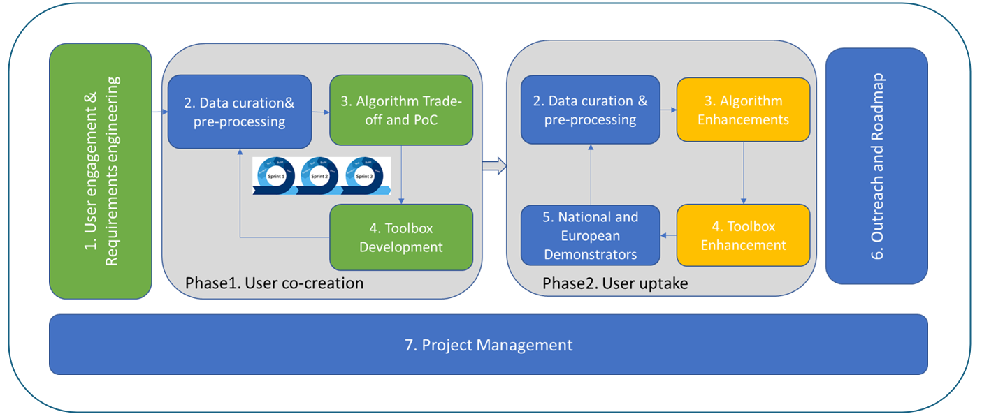
The project is split in two phases as shown in Figure. The first phase focusing on user co-creation of the solution/toolbox with Champion Users. The second phase focusing on user uptake with additional users to be selected in Phase 1.
Policy applications
The robustness and transferability of the toolbox and its system will be demonstrated to scale to larger areas (national and European continental) and will showcase the use of its results (maps and tables) for policy applications as Ecosystem Accounting, Global Biodiversity Framework and RAMSAR convention.
